| |||||||||||||
| |
|
|
|
POSITION, RELEIF AND CLIMATE |
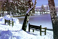
Serbia is located in the central part of the Balkan Peninsula, on the most important route linking Europe and Asia, occupying an area of 88, 361 sq. km. Serbia is in the West European time zone (one hour ahead of Greenwich time). Its climate is temperate continental, with a gradual transition between the four seasons of the year.
Serbian rivers belong to the basins of the Black, Adriatic and Aegean Seas. Three of them, the Danube, Sava and Tisa, are navigable. The longest river is the Danube, which flows for 588 of its 2.857 kilometer course through Serbia. The Danube basin has always been important for Serbia. With the commissioning of the Rhine-Main-Danube Canal in September 1992, the Black Sea and the Near and Far Eastern ports have come much nearer to Europe. Serbia is linked to the Adriatic Sea and Montenegro via Belgrade-Bar railway.
The length of Serbia's border is 2,397 km. To the East Serbia borders with Bulgaria, to the North East with Romania, to the North with Hungary, to the West with Croatia and Bosnia and Herzegovina, and to the South with Albania and Macedonia. |
 Serbia is referred to as the cross-roads of
Europe. The international roads and railways
passing down its river valleys make up the
shortest link between Western and Central Europe,
on the one side, and the Middle East, Asia and
Africa, on the other. Hence the geopolitical
importance of its territory . These roads follow
the course of the valley of the river Morava,
splitting in two near the city of Nis. One track
follows the valleys of the rivers Southern Morava
and Vardar to Thessaloniki; the other, the river
Nisava to Sofia and Istanbul.
Serbia is referred to as the cross-roads of
Europe. The international roads and railways
passing down its river valleys make up the
shortest link between Western and Central Europe,
on the one side, and the Middle East, Asia and
Africa, on the other. Hence the geopolitical
importance of its territory . These roads follow
the course of the valley of the river Morava,
splitting in two near the city of Nis. One track
follows the valleys of the rivers Southern Morava
and Vardar to Thessaloniki; the other, the river
Nisava to Sofia and Istanbul.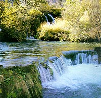 Northern Serbia is mainly flat, while its central
and southern areas consist of highlands and
mountains. The flatlands are mainly in Vojvodina
(the Pannonian Plain and its rim: Macva, the Sava
Valley, the Morava Valley, Stig and the Negotin
Marches in Eastern Serbia). 55 per cent of Serbia
is arable land, and 27 per cent is forested. Of
its mountains 15 reach heights of over 2,000
meters , the highest being Djeravica in the
Prokletija range (2,656 m).
Northern Serbia is mainly flat, while its central
and southern areas consist of highlands and
mountains. The flatlands are mainly in Vojvodina
(the Pannonian Plain and its rim: Macva, the Sava
Valley, the Morava Valley, Stig and the Negotin
Marches in Eastern Serbia). 55 per cent of Serbia
is arable land, and 27 per cent is forested. Of
its mountains 15 reach heights of over 2,000
meters , the highest being Djeravica in the
Prokletija range (2,656 m).
[ Encyclopedia | Facts & Figures | News | Search ]
© 1997 - 2001 Government of the Republic of Serbia
Email: mirs@srbija-info.yu